
Our team excels in designing customized remote sensing systems, including SAR, LiDAR, and optical technologies, tailored to meet your specific project requirements. We provide comprehensive planning with detailed, actionable insights and strategies to efficiently build your product. Additionally, our expert consultation leverages extensive industry knowledge and experience to refine your ideas into high-quality, feasible designs that align with your goals.
GNO-SYS specializes in providing custom remote sensing hardware systems tailored to your specific needs. Our highly skilled engineering team offers extensive expertise and services for the seamless integration of sensors, electronics, and software. Whether you require enhancements for airborne systems, such as drones and aircraft, or terrestrial systems, including ground vehicles and stationary platforms, we have the experience and solutions to ensure optimal performance and functionality. We work closely with you to understand your requirements and deliver bespoke systems that elevate your remote sensing capabilities to the next level.
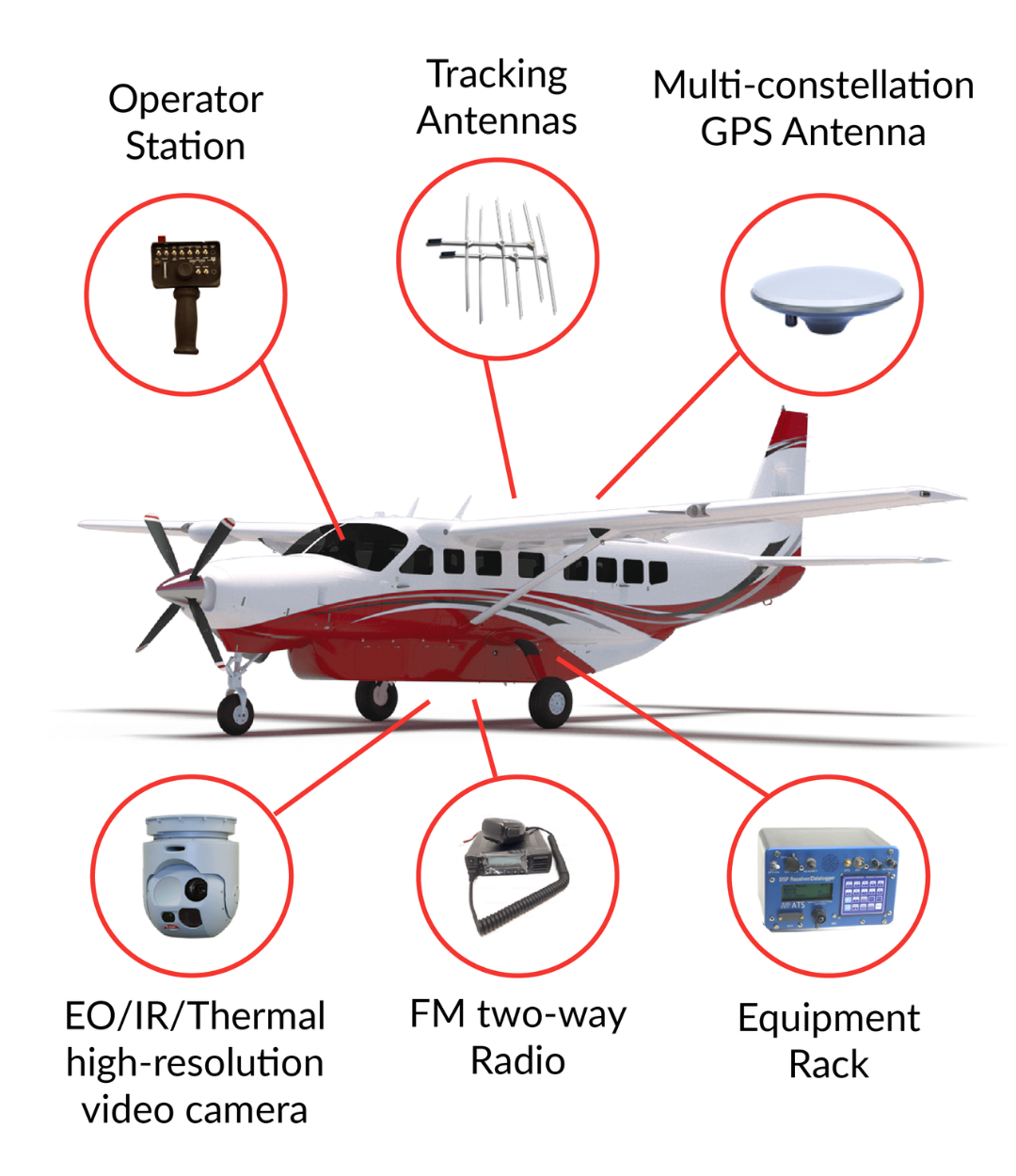
We offer mechanical design engineering services for remote sensing applications, including sensor mounts, sensor modules, and ground reflectors. Our modules are robust, rugged, and lightweight, making them ideal for use in both aerial and ground-based systems.
Our team excels in capturing accurate remote sensing data, with a focus on high-speed timing and positioning. We ensure that every detail is meticulously handled to deliver precise and reliable data for your projects.
Our expertise extends to operational software for mapping and monitoring applications. We develop customized command and control systems that encompass sensor operations, real-time monitoring, moving maps, sensor automation, and 3D navigation.
Our Synthetic Aperture Radar (SAR) systems are designed to provide high-resolution imaging capabilities for both airborne and terrestrial applications. We specialize in creating compact, lightweight, and power-efficient SAR hardware that can be integrated into various platforms. Our SAR systems include advanced timing generators, high-power transmitters, and sophisticated data capture modules, ensuring precise and reliable imaging for mapping, surveillance, and scientific research.
GNO-SYS designs custom thermal imaging systems to detect and measure infrared radiation. These systems are ideal for environmental monitoring, agriculture, military surveillance, and infrastructure inspections. Our high-sensitivity thermal cameras come with integrated power systems and real-time processing software, ensuring accurate temperature data for identifying heat sources, energy loss, and wildlife monitoring.
We offer advanced optical remote sensing systems designed to capture high-resolution imagery across various spectral bands. Our optical systems include precision timing generators, stable power supplies, and high-speed data capture units. These systems are capable of integrating with multiple sensor types, including multispectral and hyperspectral cameras, to provide comprehensive data for environmental monitoring, resource management, and scientific studies.
GNO-SYS provides bespoke multispectral imaging systems for capturing data at specific wavelengths. Ideal for agriculture, forestry, environmental monitoring, and water quality assessment, our systems integrate advanced multispectral sensors with reliable power and data capture units. They enable detailed analysis of vegetation health, soil properties, and land use changes, delivering actionable insights for resource management.
Our LiDAR systems are engineered for accurate distance measurement and topographic mapping. We develop custom LiDAR hardware with high-frequency pulse generation, powerful laser emitters, and sensitive receivers. These systems are complemented by our robust data capture and processing software, allowing for the creation of detailed 3D models of the environment. Our LiDAR solutions are suitable for applications ranging from forestry and agriculture to urban planning and disaster management.
GNO-SYS offers custom hyperspectral imaging systems that capture light across numerous narrow spectral bands. These systems are perfect for mineral exploration, agriculture, environmental monitoring, and defense. Our high-resolution hyperspectral sensors, combined with precision timing generators and advanced data processing units, provide detailed material composition analysis, ensuring accurate and efficient remote sensing.