
Mapping with Radar: Why So Few Can Do What We Do
Radar has earned a reputation in remote sensing for being among the most powerful and complex technologies to work with. While satellite radar systems have

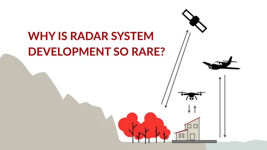
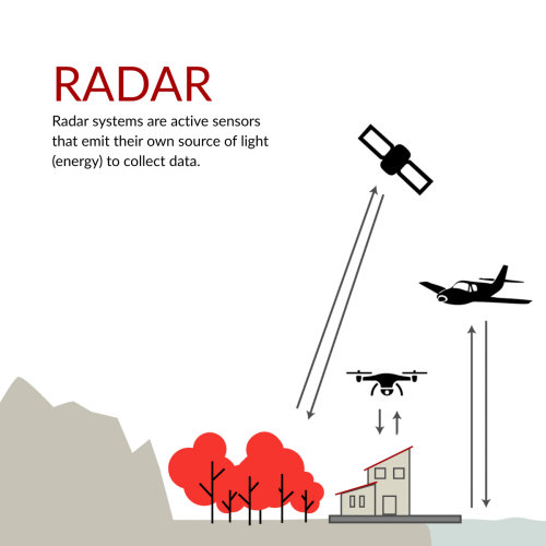
Radar has earned a reputation in remote sensing for being among the most powerful and complex technologies to work with. While satellite radar systems have become more common, airborne radar systems designed specifically for mapping purposes remain rare. And for good reason: building and operating a radar system from scratch is one of the most technically demanding undertakings in our industry.
At GNO-SYS, we’ve spent years working on custom radar systems to support complex airborne mapping missions. These systems weren’t built from off-the-shelf components;
Radar system development is a highly specialized field, and while we don’t claim to be alone in this space, it’s fair to say that very few groups globally have taken on large-scale, airborne radar mapping programs at the level we have.
For us, it’s never just been about having the right tools, it’s about understanding how to bring together the right ideas, components, and expertise to create something purpose-built, and then making it work in the air.
Radar systems are complicated, and building one is a feat of engineering. While commercial systems exist, they’re often not tailored to the demands of mapping missions. They offer convenience but come with compromises like limited flexibility, generalized capabilities, and little room to adapt to a project’s specific needs.
To truly build a system optimized for airborne data acquisition, you need a deep understanding of every layer – from hardware design and aircraft integration to radar physics and complex data processing.
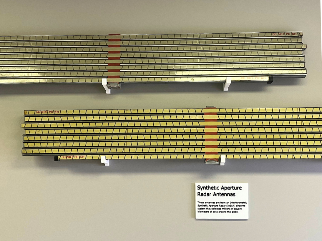
Hardware: Radar systems rely on specialized components such as waveguides, antennas, transmitters, that are hard to source and harder to configure. These parts don’t just plug and play; they must be finely tuned to work together, both physically and electronically. The system must generate precise timing, integrate with GPS and IMU sensors, manage data telemetry, and be robust enough to survive the rigors of airborne deployment. Even the chassis has to be built specifically for the application and tested.
Software: From mission planning to real-time processing, the software stack is just as complex. We develop embedded software for microcontrollers and FPGAs, handle raw data storage and telemetry, and manage massive datasets through the entire mission lifecycle.
And then comes the radar physics: working with the speed of light, managing multiple pulses, and interpreting returns filled with nuanced, overlapping signals. If the system is even slightly off in timing, calibration, or processing your data is useless.
What You Get (and What You Still Need)
After a flight, the first output from a radar mapping mission is a digital surface model (DSM), a 3D representation of the earth’s surface, complete with trees, buildings, and other clutter. But most clients aren’t looking for the surface, they’re looking for the terrain beneath it.
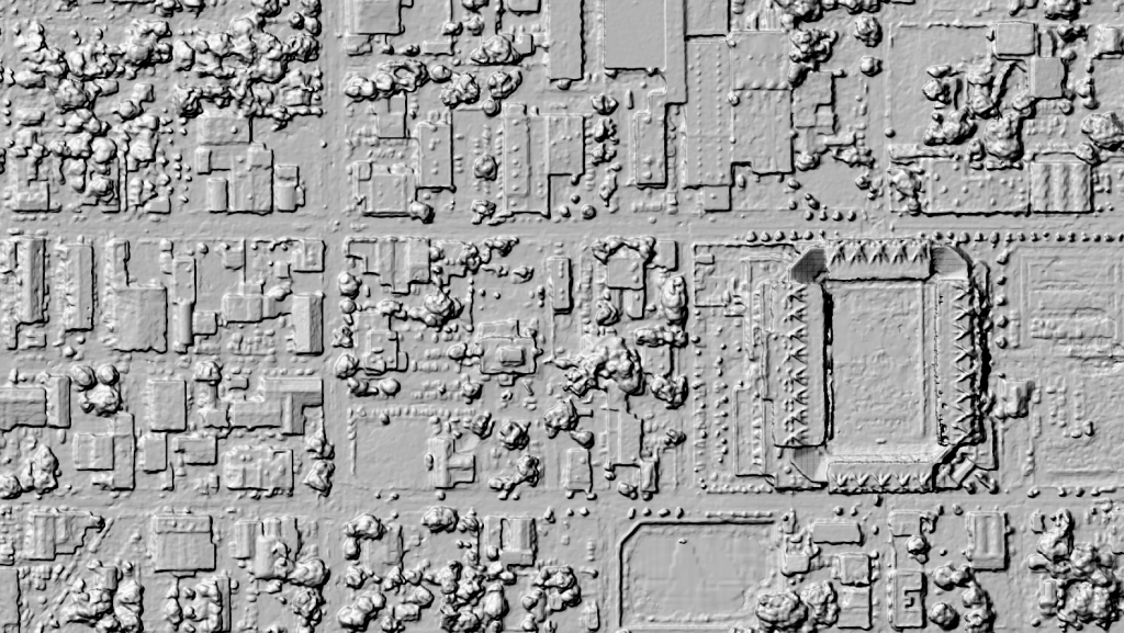
That means intensive post-processing to remove vegetation and structures and produce a bare earth model. From there, additional modeling can be done to reveal hydrological patterns, support infrastructure planning, or monitor environmental change. That final, accurate terrain model is the result of hundreds of interconnected steps, each one demanding technical precision and domain knowledge.
At GNO-SYS, we don’t just understand radar – we build it, deploy it, and extract insights from it. Our experience spans both the hardware and software domains, from antennas and transmitter design to data management and scientific interpretation.
Radar mapping is hard and that’s exactly why we do it.
Radar has earned a reputation in remote sensing for being among the most powerful and complex technologies to work with. While satellite radar systems have
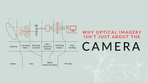
When we set out to develop a high-performance optical imaging system, we start where many do – testing commercial off-the-shelf cameras. The idea was simple:
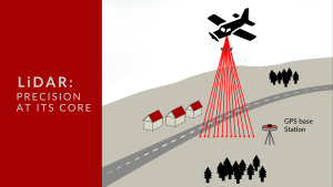
At GNO-SYS, we specialize in engineering LiDAR systems that deliver precise distance measurement and topographic mapping. Currently, our team is engaged in an exciting project to develop a custom LiDAR system tailored for a specialized application.