gno-sys technologies

GNO-SYS guide to a seamless sensor integration

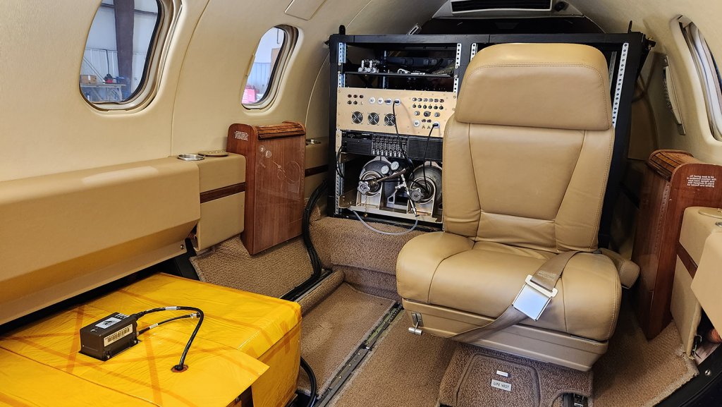
Recently we had the privilege of supporting IO Aerospace in the integration of sensor technology on their newly transformed IO Special Missions Platform. With our expertise in sensors, we were brought in to support the installation and ensure a smooth integration process. 

However, this is just one step in the journey. At GNO-SYS we support clients at all stages by providing custom services to address their unique needs. Before we even discuss specifics we sit down with our client and discuss exactly what it is they want. At a high-level we look to understand the project and then we dive into the sensor systems themselves.

In this blog we look at some of the essential factors to assess when configuring and integrating sensors, while looking at the process through the lens of our recent work on the IO Special Missions Platform.

One of the first steps to determine when looking at any sensor integration project ensuring you select the optimal method for data acquisition. It could be car or a satellite, other airborne options like airplanes and drones are often used but what it really comes down to is finding the right fit for the mission. To determine this, factors such as sensor type, environment conditions, and project requirements should always be considered. Additional factors like sensor compatibility, reliability, scalability, and ease of maintenance are also important to assess and further enable optimizing and automating workflows later on. At GNO-SYS we always look to answer the question – Is this the best approach to the job?

When going into the IO Aerospace project we first had a discussion with the client about mission objectives, concerns and challenges. From this conversation we knew we were going to be testing sensor technology pre-space and needed to be able to stimulate space-like conditions. With additional requirements to monitor and map large areas with detailed precision as well as the sensor type and size, we knew a larger aircraft would be the ideal platform for the mission.

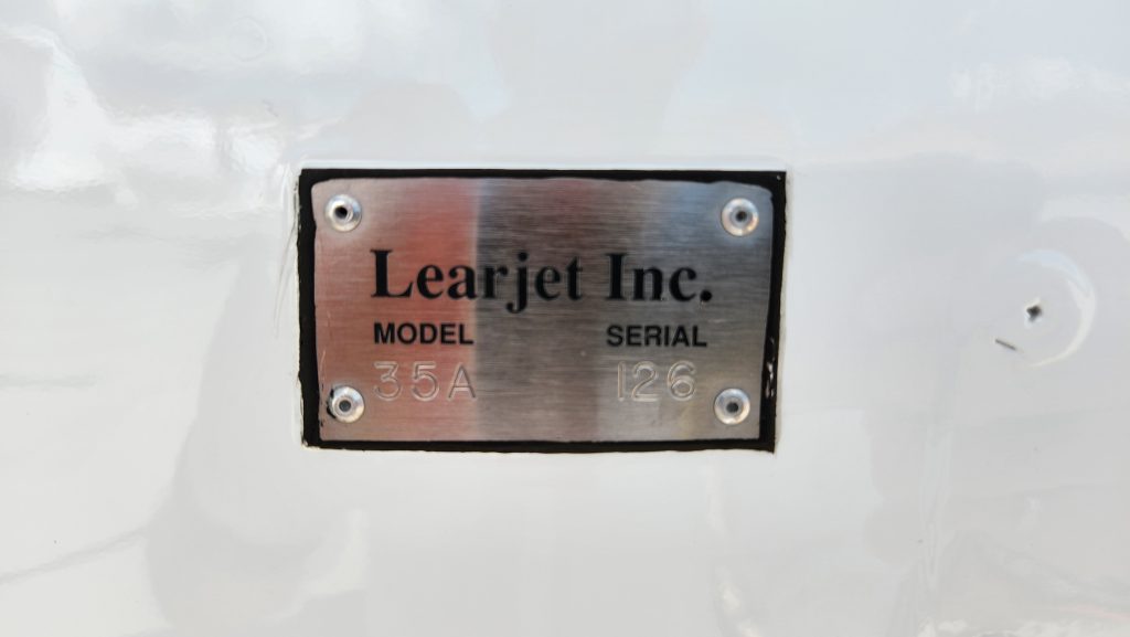
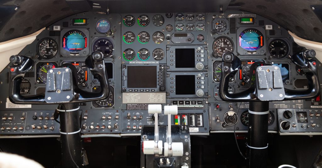
Assessing which particular type of aircraft would be best took a bit more consideration. Structural changes were required to accommodate the camera boxes and sensor systems. As well with the added weight from modifications the aircraft would need to be able to maintain the increased payload at high altitudes for sustained periods. After weighing various options ultimately, a Learjet 35A was the ideal platform for the mission.

From there we took a deeper dive into the sensor system itself. We wanted to ensure that prior to installing the system in the aircraft the sensor was in optimal condition for accurately and reliably collecting the data needed for the mission.

1. Positioning and Timing

Positioning and timing are critical for accurate sensor measurements. Even the slightest deviation can lead to inaccuracies in the data collected. When working with our clients we always emphasize the importance of precise timing and synchronization of clocks across all the sensor components. Positioning and timing is also important to ensuring accurate validation of the data collected. GNO-SYS has standard architecture for hardware and software that we can recommend and implement for clients with complicated systems of four to five modules, synchronizing them and creating a smoothly functioning multi-sensor system. 

For the IO Aerospace Special Missions Platform the first thing we assessed was the positioning and timing of the sensor they were looking to install. Our main goal when assisting any client with sensor work is to ensure accuracy and reliability in order to allow for automating and scaling the project. With this in mind we recommended an improved design and assisted to implement a better solution for timing and positioning of the sensor using commercially available systems.

2. Command and Control

Command-and-control play another pivotal role in the integration of sensors. Whether you are dealing with multiple sensors or complex environments, command-and-control starts and ends with the user. When designing a command and control structure we always assess and make recommendations on multiple elements including monitoring the system for status, configuring in a structured manner, handling faults, mission planning and so on. Not only does this enable a more seamless integration it allows for enhanced automation and optimization of the system.

After we were able to improve the positioning and timing of the sensor we looked at addressing various factors of command and control. In this case, there was already a significant framework and a clear pre-existing system. Some prototype code had already been developed, which we built into a fully operational tool. Our team was able to support by making incremental, and critical, improvements to the system. From there we continued to support through mission planning and operator capabilities.

3. Data Acquisition and Analysis

The actual process of data acquisition and analysis is another vital factor to consider when looking at how best to integrate sensors. Decisions regarding when, where, and how to record, store, and analyze data can have significant downstream impacts. Our experience performing data acquisition spans across various sensor types and mission profiles. Whether visual, LiDAR, radar, spectrometry or so on, our team confidently supports any sensor project with their in-depth knowledge of systems – while still maintaining an open mindset with each project ensuring that clients unique needs are met. With this experience acquiring and analyzing data we build systems to process, manage, and interpret by automating as much as possible and allowing for processes and workflows to be operationalized. By doing so we are able to scale clients data acquisition and projects while ensuring accuracy and repeatability. To optimize workflows, it can help to determine whether certain factors such as whether data processing should occur on site or on the ground. It is also important to evaluate additional elements regarding sensor type and environment conditions to ensure effective and accurate data acquisition.

When it came to the IO Special Missions Platform we knew that the data acquired needed to be processed in a cloud based environment with a quick turn around. Additionally we wanted to be able to automate workflows as much as possible. One way we did this was through engineering the software and electrical connection to allow for flight planning to feed directly into the cockpit. In the sensor integration we were able to connect the system to the aircrafts autopilot so that mission planning would be able to inform the sensor and its operator as well as the pilots.


Sensor integration is a complex process that requires careful consideration of several factors. At GNO-SYS, we understand the importance of positioning, timing, command and control, data acquisition and analysis and choosing the right platform. By taking a comprehensive and holistic approach and customizing our services to meet a client’s specific needs, we ensure successful sensory integration and enable our clients harness the full potential of remote sensing capabilities.

what is SAR (Synthetic Aperture-Radar)

Selecting Your System: Synthetic Aperture Radar (SAR) Technology 

When it comes to high-resolution imaging for both airborne and space applications, Synthetic Aperture Radar (SAR) systems provide unique advantages. SAR technology, increasingly popular over the past decade in satellite imaging, enables precise, high-resolution data collection that traditional optical systems can’t match, especially in challenging conditions. For satellites, particularly those

Read More>>

How We Design Custom Systems to Achieve the Best Possible Outcome

Many factors must be closely assessed when designing custom remote sensing systems. Whether using SAR, Optical Imagery, or Near Infrared, each system must align with the specific needs of the client and the data needed. From resolution to data collection to platform integration to budget, the timeline for all factors must be assessed for optimal results.

Read More>>
Internet of behaviour (IoB)

Location Intelligence and the “Internet of Behaviour”

Have you ever wondered how much your location data can tell about your daily habits? With the increasing adoption of Internet of Things (IoT) devices, this data is becoming a goldmine for understanding human behavior. In fact, a report predicts that by 2030, 75% of all devices will be IoT devices. Welcome to the era of the ‘Internet of Behaviour’ (IoB), where geospatial technology is taking center stage.

Read More>>