
Mapping with Radar: Why So Few Can Do What We Do
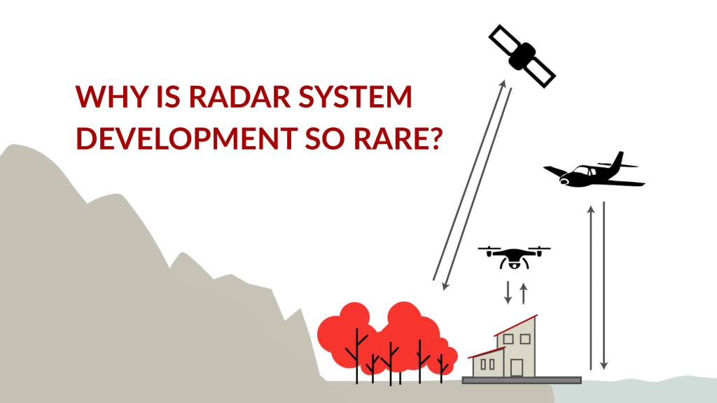
Radar has earned a reputation in remote sensing for being among the most powerful and complex technologies to work with. While satellite radar systems have become more common, airborne radar systems designed specifically for mapping purposes remain rare. And for good reason: building and operating a radar system from scratch is one of the most […]
Why Optical Imagery Isn’t Just About the Camera
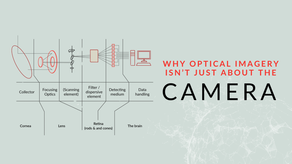
When we set out to develop a high-performance optical imaging system, we start where many do – testing commercial off-the-shelf cameras. The idea was simple: find a camera with the right specifications and integrate it into an aerial platform. But as we quickly learned, optical imaging for aerial applications is much more than just choosing […]
Exploring LiDAR Technology with GNO-SYS
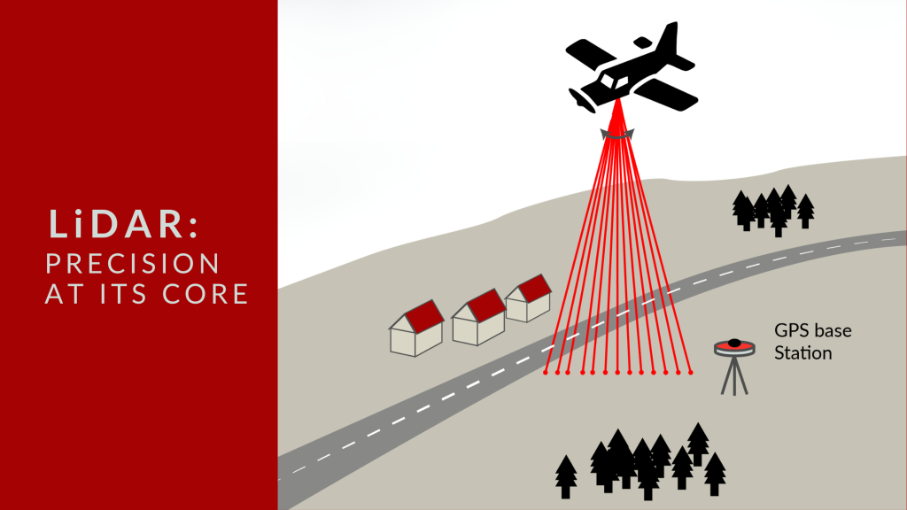
At GNO-SYS, we specialize in engineering LiDAR systems that deliver precise distance measurement and topographic mapping. Currently, our team is engaged in an exciting project to develop a custom LiDAR system tailored for a specialized application.
Selecting Your System: Synthetic Aperture Radar (SAR) Technology
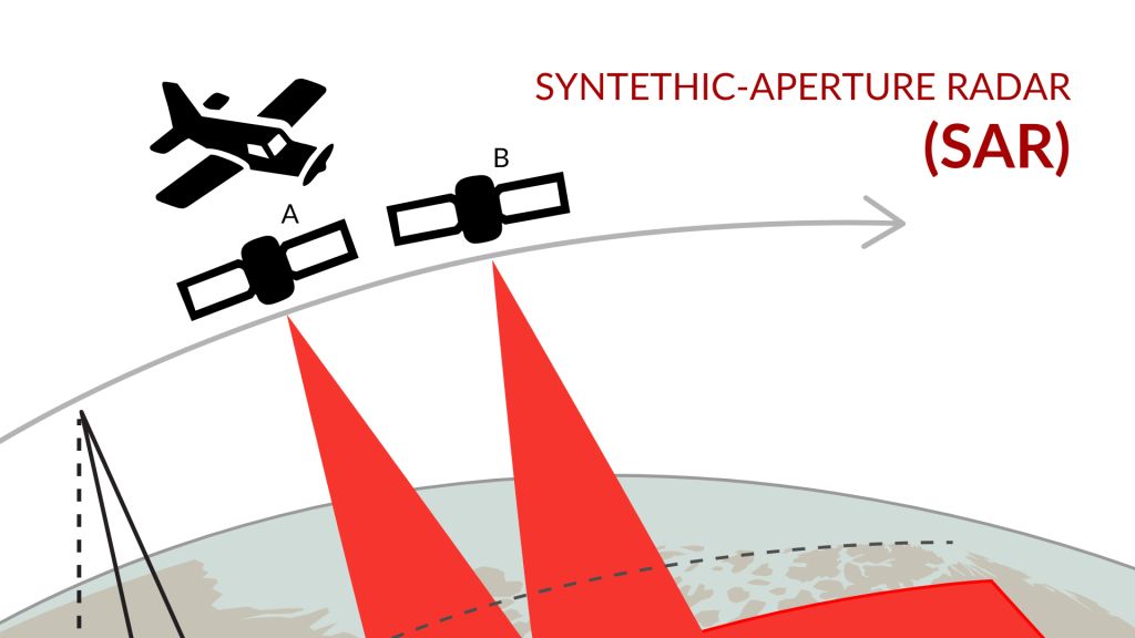
When it comes to high-resolution imaging for both airborne and space applications, Synthetic Aperture Radar (SAR) systems provide unique advantages. SAR technology, increasingly popular over the past decade in satellite imaging, enables precise, high-resolution data collection that traditional optical systems can’t match, especially in challenging conditions. For satellites, particularly those in Very Low Earth Orbit […]
How We Design Custom Systems to Achieve the Best Possible Outcome
Many factors must be closely assessed when designing custom remote sensing systems. Whether using SAR, Optical Imagery, or Near Infrared, each system must align with the specific needs of the client and the data needed. From resolution to data collection to platform integration to budget, the timeline for all factors must be assessed for optimal results.
Location Intelligence and the “Internet of Behaviour”
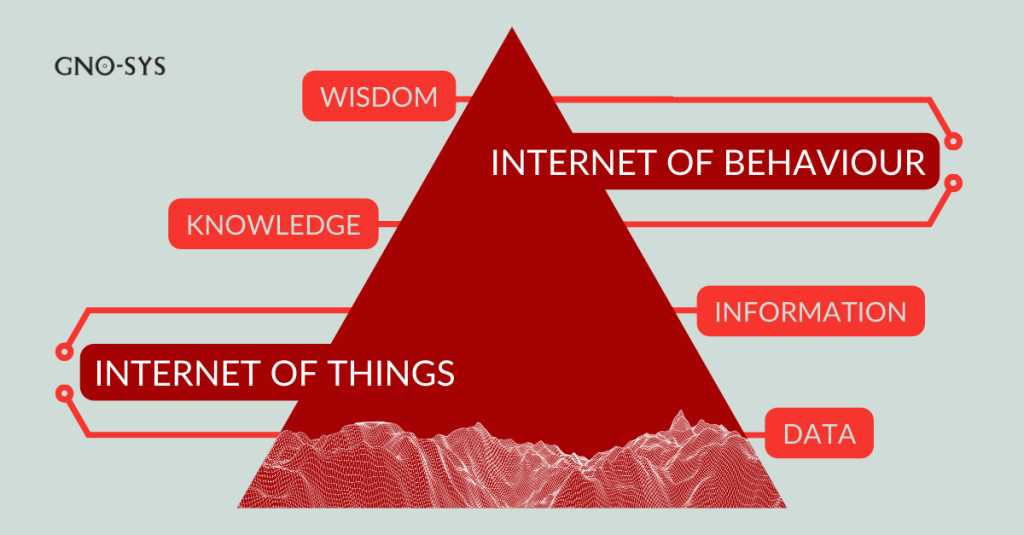
Have you ever wondered how much your location data can tell about your daily habits? With the increasing adoption of Internet of Things (IoT) devices, this data is becoming a goldmine for understanding human behavior. In fact, a report predicts that by 2030, 75% of all devices will be IoT devices. Welcome to the era of the ‘Internet of Behaviour’ (IoB), where geospatial technology is taking center stage.
Crafting an Automation Strategy: A GNODe Guided Approach
Discover the importance of a data automation strategy and learn about the GNOde Guided Approach. Optimize your data processes with customized workflows, API integration, and scalable solutions for enhanced efficiency and productivity.
It’s Wildfire Season: How the Geospatial Industry Protects Communities and Supports Regrowth
Discover how the geospatial industry is battling wildfires through predictive modeling, real-time monitoring, and emergency planning. Learn about companies making a difference in wildfire management and post-fire recovery. Explore the vital role of spatial technology in safeguarding communities and preserving our environment.
The Crucial Role of Geospatial Technology in Oil and Gas
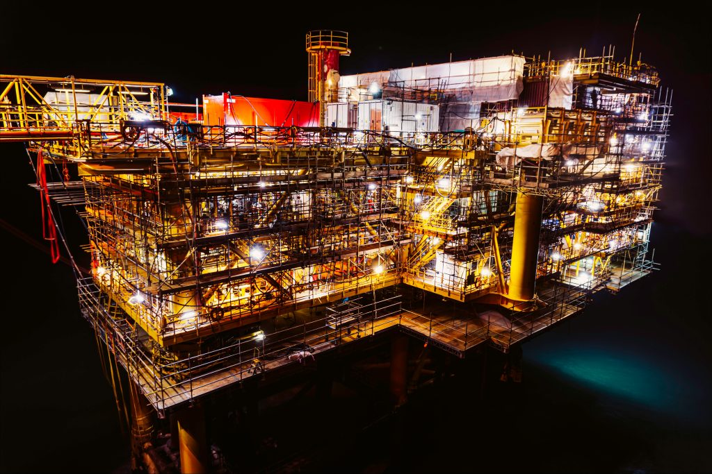
The Crucial Role of Geospatial Technology in Oil & Gas In the Canadian oil and gas industry, geospatial technology is a vital ally, seamlessly integrating data-driven insights to enhance exploration, production, and decision-making processes. This blog will dig into how the geospatial industry serves the specific needs of the oil and gas sector in Canada, […]
HaySTAC: Streamlining Geospatial Data Management with Compliance and Security

HaySTAC: Streamlining Geospatial Data Management with Compliance and Security Data has become the driving force behind many critical decisions today. Geospatial data, in particular, plays a crucial role in various industries, including transportation, agriculture, and urban planning. However, managing geospatial data can be a daunting task, especially when it comes to compliance, scalability, and security. […]