Recently we’ve been working on a few projects that involve change detection in satellite imagery. Change detection has been a mainstay of the remote sensing industry since its inception but today’s change detection has evolved a long way from what it used to be.
The obvious place to start is imagery resolution. In the past decade the resolution of satellite imagery has gone through the roof! Today we have systems like Satellogic at 70cm pixels, Planet at 50cm, and Pleiades Neo down to 30cm! The other major revolution in satellite remote sensing has been the number of satellites in the sky, and the number of companies who are building out significant constellations. The final revolution in remote sensing is that we’re no longer bound by the power of our desktop computers to process, analyze, manage, and understand this data. We have the ability to spin up multiple instances, with multiple CPUs and GPUs and can perform CPU-years of processing in a few days.
With all these high-resolution pixels coming from all these satellites it’s impossible for a human to look at all of them. It’s a common refrain in the geo community that people don’t want pixels, they want products, or better yet insights and understanding. The paradigm shift from pixels to insight underscores a fundamental truth: imagery serves as a means to an end for the user. What truly matters is not the minutiae of pixels but the derived insight, the answer, the “so-what” that empowers informed decision-making.
The Evolution of Data Processing
Automated data processing leverages algorithms and machine learning to streamline workflows, ensuring quicker turnaround times and enhanced accuracy in data analysis.
Automated data processing provides many benefits for those of us that work with spatial data. It enhances efficiency by reducing processing time, allowing engineers to focus on complex tasks, accelerating timelines, and improving overall productivity. Additionally, automation ensures consistent and accurate data analysis, crucial for precision in applications such as land use planning and environmental monitoring. Lastly, automated processes are highly scalable, adapting seamlessly to varying data loads in both small-scale and large-scale projects without compromising performance.
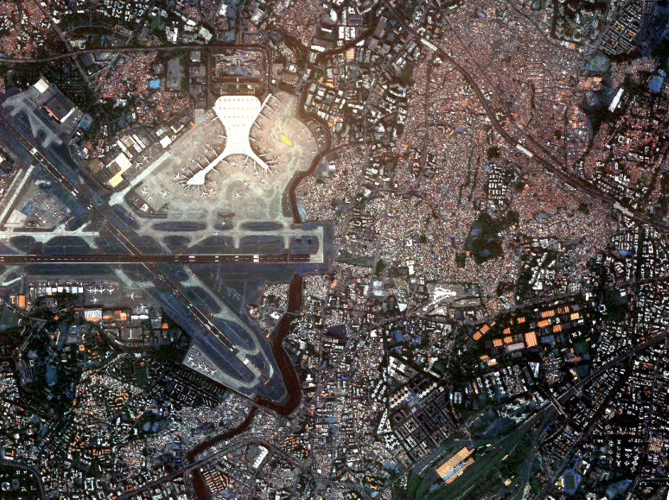
Automating our processes is crucial because our customers need us to cover large areas frequently, a task too challenging and expensive for manual efforts. In a specific project in Mumbai, automation proved essential. The client was looking to identify changes in infrastructure, like new buildings going up, existing buildings coming down, or new roads going in. The city’s busy environment made it difficult for human eyes to spot subtle changes. Only through automation could we efficiently detect and monitor these changes, fulfilling our customers’ specific needs.
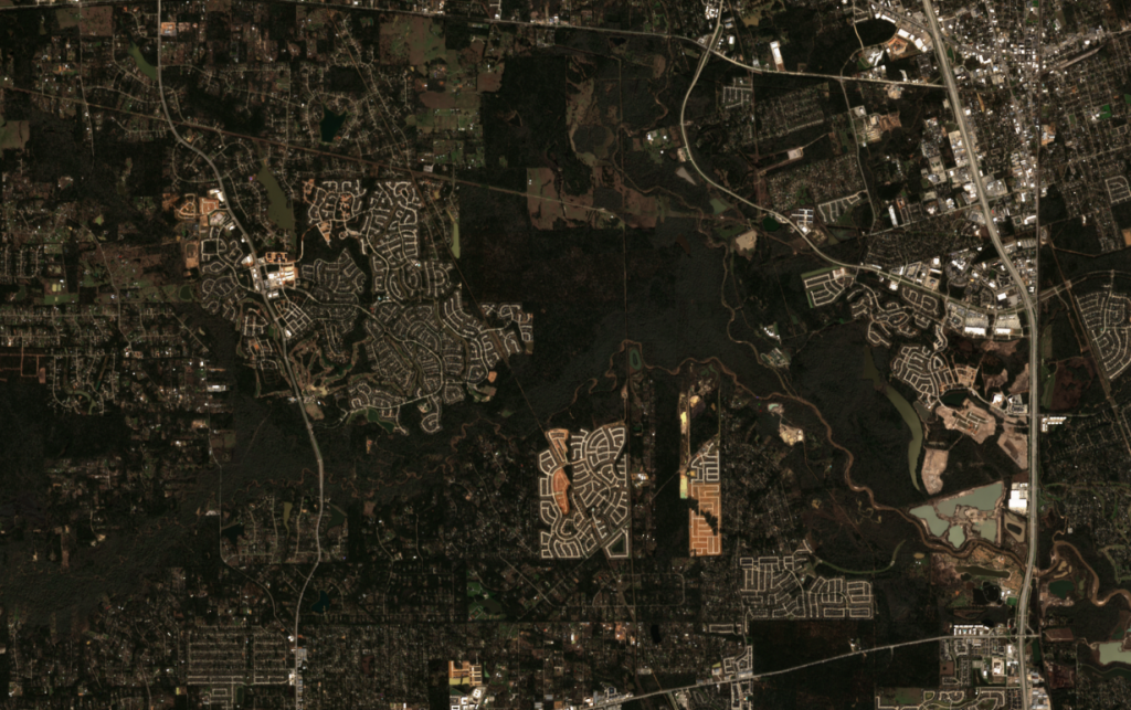
For another project we worked with a client who was looking for very new construction around fast-growing urban areas. This sort of change could be easily detected by people reviewing the imagery, however when we scale this work out across a county, or a state it becomes impractical at best to this with people.
Change Detection in Geospatial Engineering:
Change detection involves identifying alterations in the Earth’s surface over time. This could range from urban expansion, to deforestation, land use changes, and infrastructure growth or deterioration. Automated change detection processes play a pivotal role in providing real-time insights into these transformations.
Enabled by APIs from data providers, cloud systems can quickly acquire, process, and alert on changes. Humans are not required, except for quality control and quality assurance (QC/QA). This seamless integration of automated processes ensures efficiency and timeliness in monitoring Earth’s evolving landscape while allowing human expertise to focus on ensuring the accuracy and reliability of the detected changes.
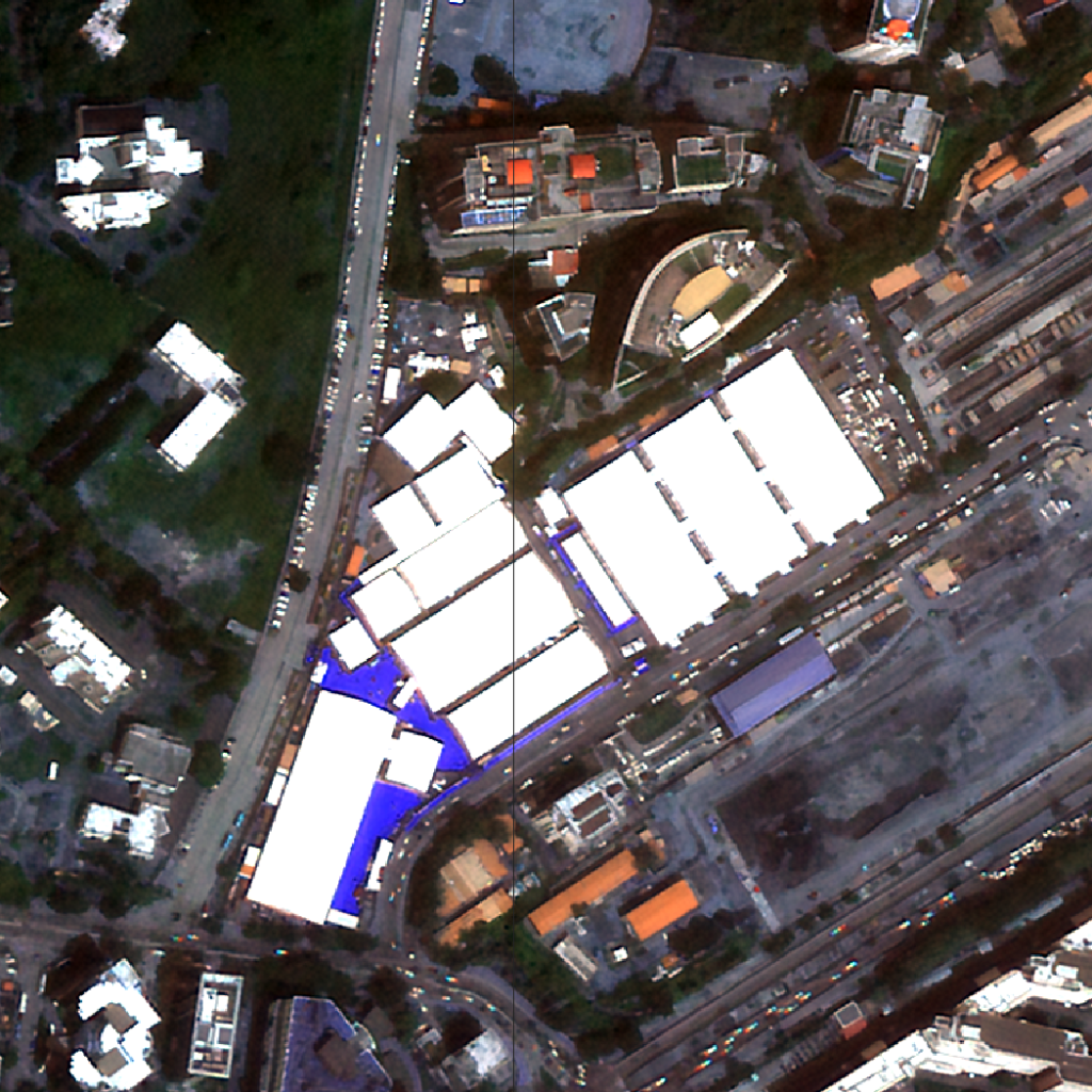
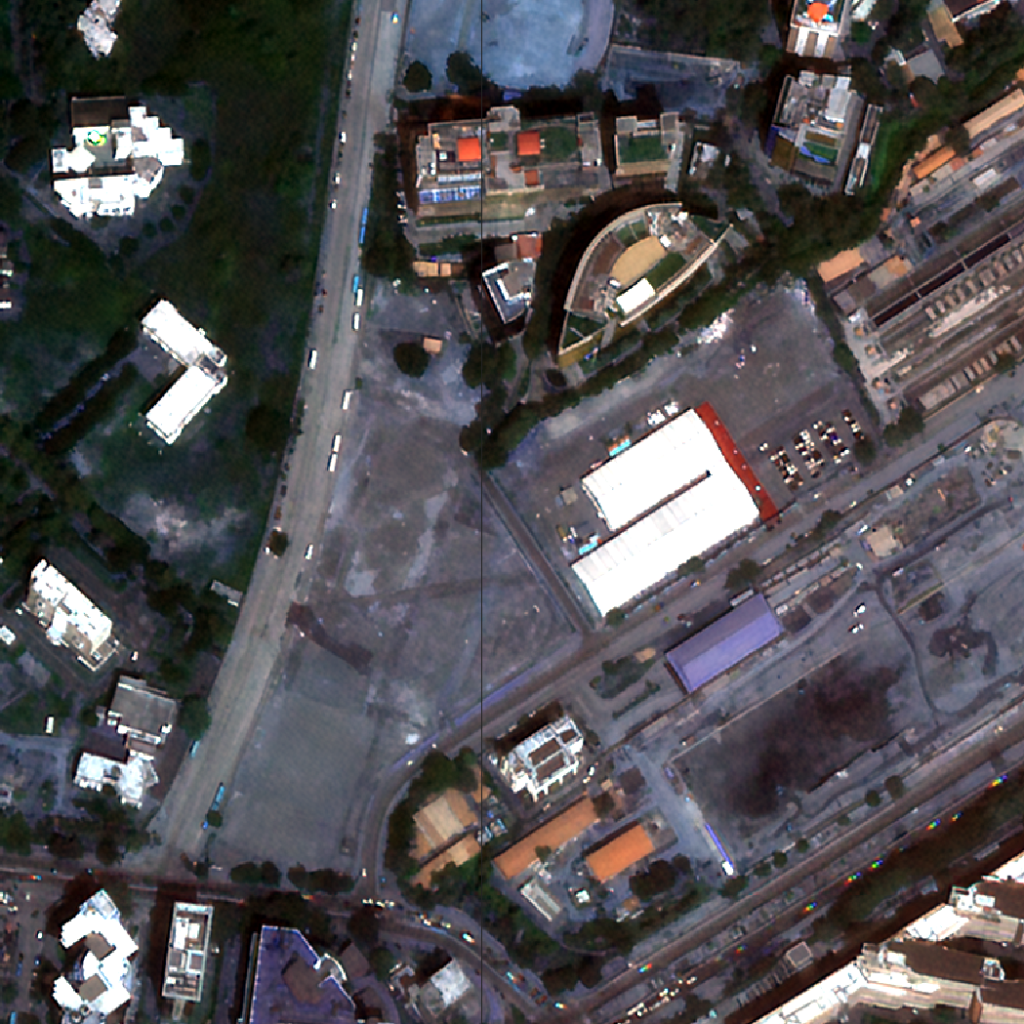
In this example you can see the growth and change of a neighbourhood over time.
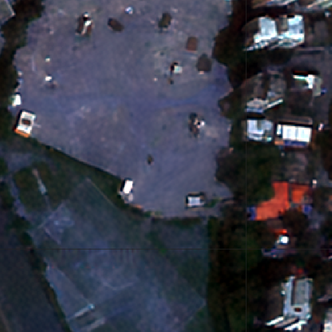
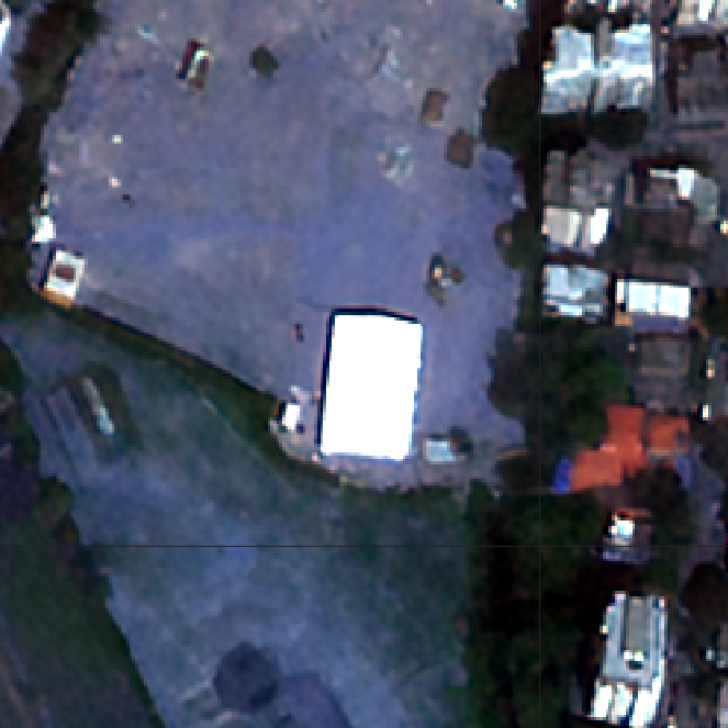
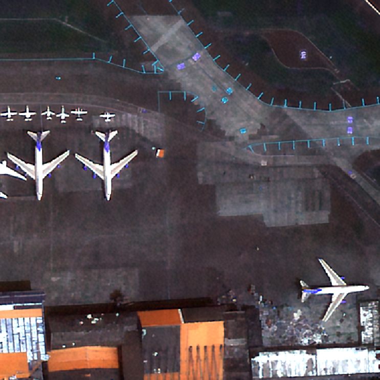
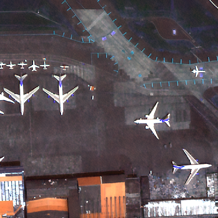
In these examples, the images were taken less than a week apart, and the construction and demolition of buildings is clear and obvious when viewed this way.
Building added
Warehouse removed
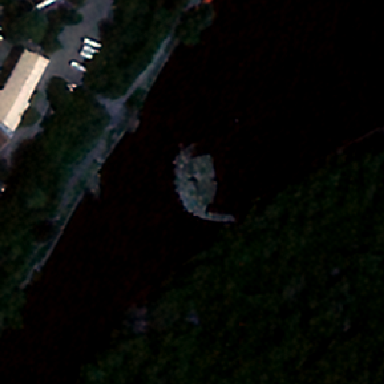
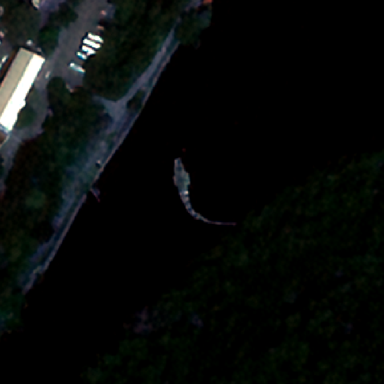
Aircraft have moved
Water level covers land
By automating the change detection for these projects through GNOde we can easily ingest the data required, process the imagery, identify the changes, and then bring a person into the loop. We love automating as much as possible, but it’s still critical to have a person in that final step checking to verify and perform QC on the data outputs.
In both cases we were able to streamline the process of satellite image change detection through a scalable, secure, cloud-based approach. The clients both receive the insights and information that they need without having to view each and every pixel.